Another hazy, hot and humid day is ahead this Saturday to kick off the weekend in South Florida!

A Heat Advisory is in effect from 8AM through 5PM for feels-like temperatures as high as 109F today across Miami-Dade and Broward Counties.
Today is forecast to be the nicer half of the weekend with a northeast wind in place. With enough moisture in the air, that onshore wind may draw in a couple morning showers following by scattered, afternoon, inland showers and thunderstorms possible during the afternoon.

Heading into Sunday, it turns more unsettled as a disturbance up in the atmosphere swings across Florida from the Atlantic Ocean. This will help stir up the atmosphere, fueling the risk for scattered showers and storms at any point of the day.
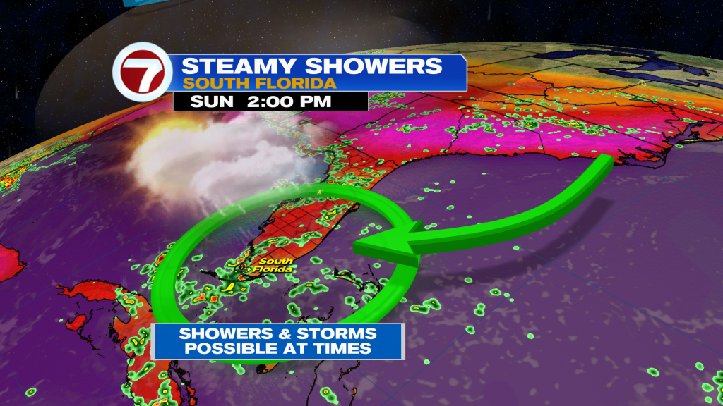
Unfortunately, this may disrupt the Panthers Parade in Fort Lauderdale with rain chances up to a 50-60% chance. It’s not looking like a washout but it would be ideal to bring the rain gear to the parade! Otherwise, it will be a mostly cloudy and muggy day with high temperatures in the upper 80s during the afternoon.

Through much of next week, a rather typical summertime weather pattern is forecast to be in place as July begins! Expect the chance for isolated to scattered morning showers with activity then gradually focusing more inland during the afternoon hours. High temperatures are forecast to be seasonable, hovering in the low 90s.

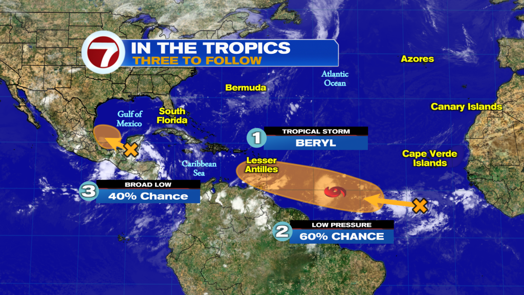
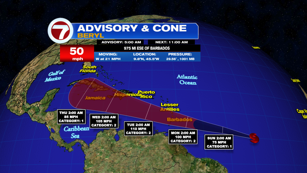
In the tropics, the second named system of the Atlantic hurricane season has formed: Tropical Storm Beryl.
Beryl will bring impacts, unfortunately, to the Windward Islands on Monday as the storm crossed the island chain then as a forecast Category 2 hurricane. It will then continue to travel west-northwest next week, potentially bringing at least some impacts to parts of the Greater Antilles. The risk for impacts to the mainland US are low as of now but this system is important to continue to monitor in case the forecast shifts.
There are also two other areas in the Atlantic basin to monitor for potential development: one near the Yucatan Peninsula and a tropical wave behind Beryl. Both have medium chances of formation. The area near Mexico will move over the Peninsula today, and then could briefly develop later this weekend or early next week over the Bay of Campeche before moving into Mexico.