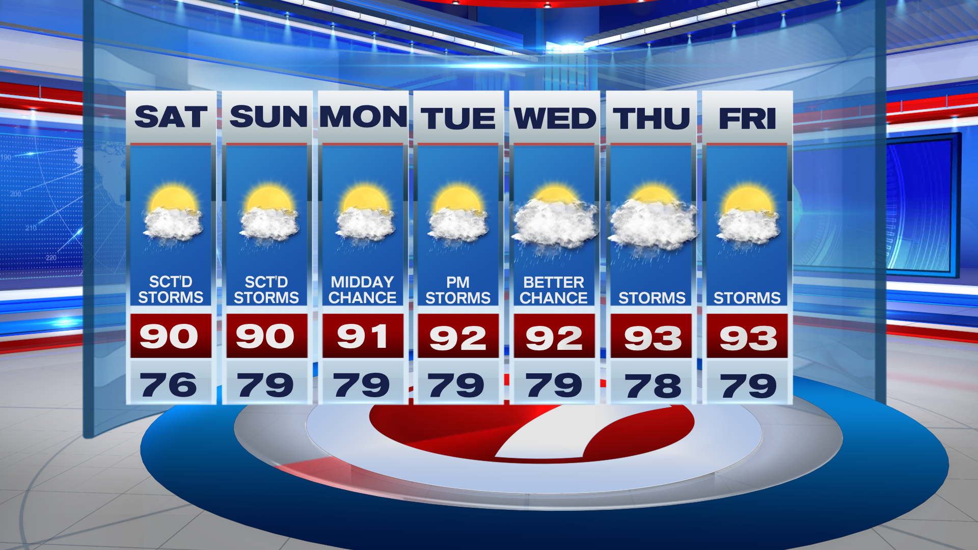
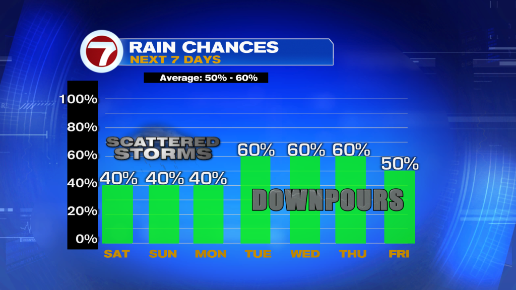
A very summerlike weekend is ahead as we progress toward the end of June with typical temperatures, high humidity and that usual risk for seeing showers and thunderstorms.
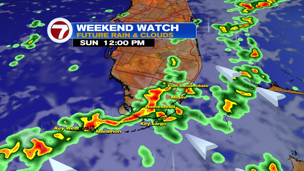
Both today and Sunday will be fairly similar with the chance for scattered showers in the morning — especially late-morning as daytime heating increasing — and possible storms during the afternoon. The highest risk for seeing afternoon storms will be inland and to our west given a southeast wind.
That southeast wind will also lead to high temperatures around 90F with feels-like temperatures maxing out near 100F at most locations.
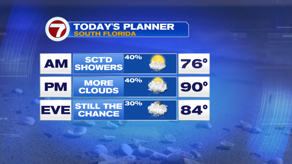
In terms of sky conditions throughout the weekend, we will see more clouds than sunshine. Blue skies will favor the morning hours and then more clouds will become dominant during the afternoons.
The setup will remain fairly similar on Monday to begin the new work week before a southwest wind flow begins to become more dominant for the large remainder of next week. This will aid in a higher chance for midday/afternoon thunderstorms while temperatures turn hotter in the low to mid 90s.
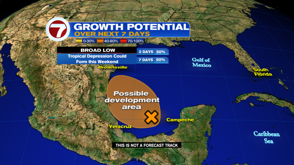
In the tropics, there are no longer any active storms and now only one area to watch for potential development. It’s a broad area of low pressure over the Bay of Campeche and this system has a medium chance of developing into a tropical depression or storm over the Gulf of Mexico over the next seven days. It is not a risk to Florida.