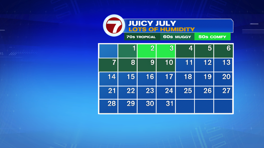
It’s been a brutal week of humidity and while you might think that means this work week, it’s been this way for the last 7 days — a full week of tropical humidity! Since July 1st, we’ve only had two “comfortable” days where dew points were in the 50s, otherwise it’s been all about the sticky, muggy and tropical air. Don’t expect that to change anytime soon with several more tropical-like days in the forecast.
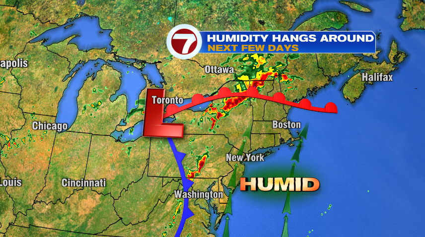
The remnants of ex-hurricane Beryl are currently moving through Great Lakes and eventually Upstate New York and northern New England. For them, the threat turns to severe weather, including tornadoes, and flooding. While we don’t have those threats here in southern New England, a tropical system nearby means tropical moisture and tropical humidity. We’ll keep this level humidity around until Sunday!
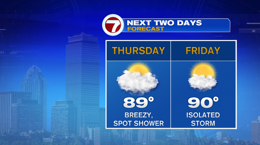
Tomorrow might feel a LITTLE better than the last few days but it’s all about perspective. We’ll have more clouds in the morning which will slow down our temperature climb a bit. More sunshine in the afternoon will still boost our temperatures close to 90° for the afternoon. The humidity will still be tropical, but there will also be a good breeze developing and that moving air will be more tolerable if you’re outside than the more stagnant air masses. It’s possible we see an isolated shower, but it’s only about a 30% chance of a passing shower. Friday we go back to the pattern of heat and humidity and a pop up storm chance, like we’ve seen the last few days.
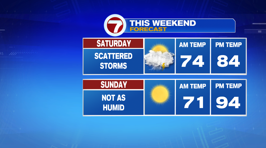
The weekend forecast is split, in a few different ways. Our best chance of rain and storms is actually Friday night into Saturday (bummer for your weekend, I know). Saturday will be wetter, cloudier and because of that, cooler. But it still stays ridiculously humid. Sunday the sun will be out in full force. That will send our temperatures back into the 90s! The nice part about Sunday, however, is humidity will be lowering through the day. So while it’s hot, it’s not overly humid.